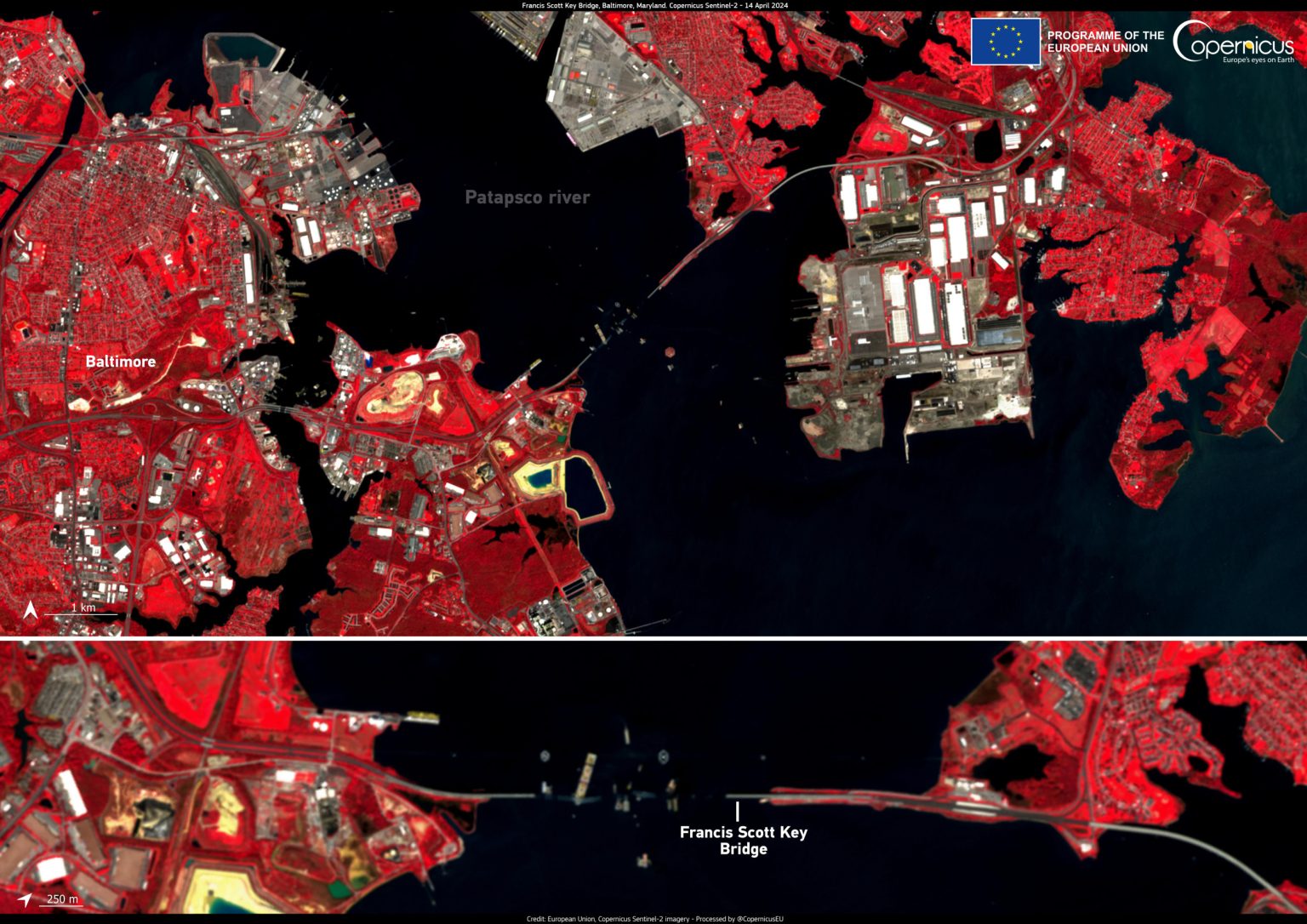
The aftermath of the collapse of the Francis Scott Key Bridge in Baltimore, caused by a collision with the container ship MV Dali, has been captured in images taken by the Copernicus Sentinel-2 satellites on April 14. The pictures show the scene in the Port of Baltimore three weeks after the incident, with the Dali still visible and a huge gap in the bridge’s structure. The disaster is believed to have claimed the lives of six people, with only four bodies having been recovered from the Patapsco River.
The container ship Dali, measuring 985 feet in length, collided with the bridge at a speed of 9 mph after losing power in the early hours of March 26. As a result, much of the bridge collapsed into the water almost instantly. Eight construction workers who were repairing potholes on the bridge at the time, and taking a break in their cars, fell into the water during the collapse. While two were rescued, the remaining six were presumed dead. So far, only four of the workers’ bodies have been recovered. The National Transportation Safety Board is conducting an investigation into the incident, which is expected to take between 12 and 24 months.
The satellite images of the aftermath of the bridge collapse in Baltimore may provide valuable insights into the disaster scenario. While it is unclear whether the images will be used in the crash investigation, satellite imagery is increasingly being utilized in studying such incidents. Examples include using satellite data to inform humanitarian responses after disasters like heavy rains causing landslides in Mozambique following Tropical Cyclone Idai in 2019. In the case of the Francis Scott Key Bridge collapse, several containers on board the Dali carrying toxic chemicals were breached, spilling their contents into the harbor. The EPA has been closely monitoring the situation to ensure there is no threat to drinking water safety.
Efforts to clean up and salvage the debris from the collapsed bridge in Baltimore are ongoing, with the heaviest section so far weighing about 450 tons. Bridge collapses from collisions with ships are rare occurrences, but have been reported in various incidents over the years. According to a report by the World Association for Waterborne Transport Infrastructure, between 1960 and 2015, 35 significant bridge collapses globally were caused by ship or barge collisions, resulting in 342 fatalities. The use of satellite imagery and advanced technology can aid in assessing and responding to such disasters. Newsweek encourages readers to share tips or questions related to science stories such as the Baltimore Bridge collapse.
As the investigation into the Francis Scott Key Bridge collapse continues, authorities are working to gather all necessary information to understand the cause of the incident and prevent future tragedies. The satellite images captured by the Copernicus Sentinel-2 satellites offer a unique perspective on the aftermath of the disaster, highlighting the extent of the damage caused by the collision. The recovery efforts, including the retrieval of bodies and hazardous materials from the water, are ongoing, with agencies like the EPA closely monitoring the situation to ensure public safety. Through advanced technology and analysis, valuable lessons can be learned from this tragic event to improve safety measures and response strategies in the future.


